An New Way of Tracking Hurricanes
Some tropical storms rapidly become category five hurricanes. Cutting-edge saildrones are revealing how this happens.
Hurricane Otis hit southern Mexico on October 25, 2023, with 165mph (270km/h) winds, killing at least 27 people and causing widespread damage and power outages in Acapulco. NOAA described Otis as a “life-threatening storm surge” with destructive winds and heavy rainfall, leading to flash flooding and mudslides. Otis intensified by 110mph (177km/h) within 24 hours.
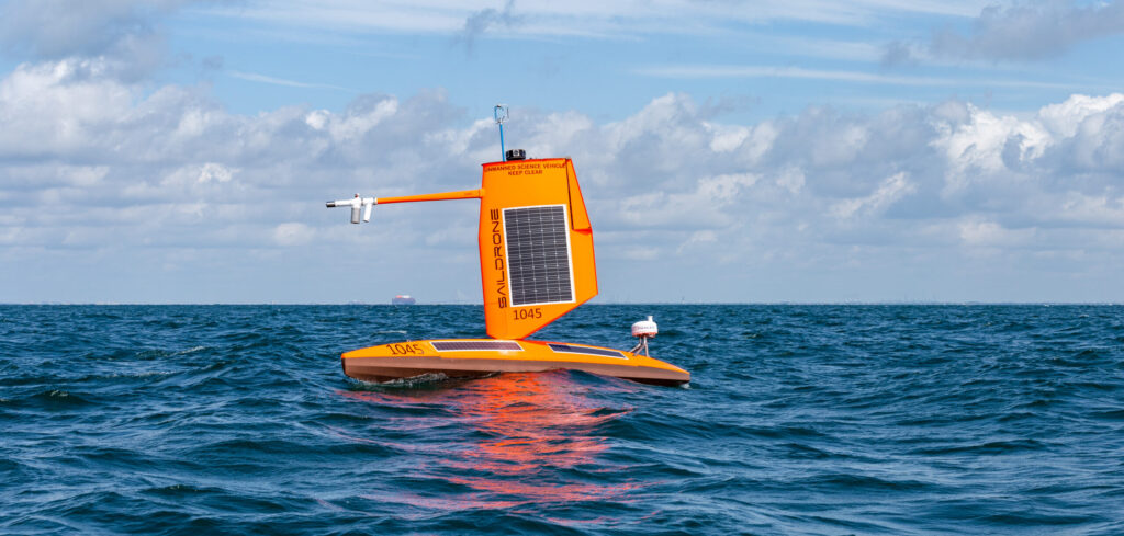
Scientists aim to understand why these storms intensify so quickly. NOAA, partnering with Saildrone, uses seafaring drones to collect oceanic and atmospheric data. Saildrones, which resemble sailboats and range from 23ft (7m) to 65ft (20m), use wind propulsion and solar-powered sensors to measure hurricane paths and intensity changes. They also analyze ocean currents, creating a comprehensive picture of the air and water column.
The mission is not about predicting hurricanes but improving future hurricane modeling by studying their intensification. Hurricanes form over warm waters, where evaporating water creates low pressure, drawing in more air and forming storms. When wind speeds reach 74mph (119km/h), it becomes a hurricane. Kerry Emanuel from MIT notes the importance of understanding heat transfer from the ocean to the atmosphere, a gap the saildrones aim to fill.